

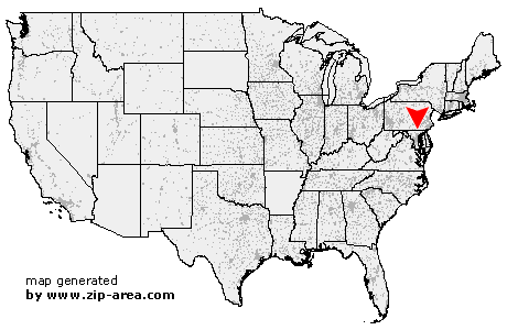
Railroad
| Category: | City |
| State: | Pennsylvania |
| County: | York |
| Area code: | 717 |
| FIPS code: | 42133 |
| Time zone: | EST |
| ZIP code: | 17355 |
|
calculate distance to another city

|
|
 Using the left mouse click, select the desired location on the map and you will receive a list of cities in the surrounding area. (Embed this map on your website.) |
Add the following HTML-code to your website: <a href="http://www.zip-area.com/pennsylvania/railroad/" target="_blank"><img src="http://www.zip-area.com/pennsylvania/images/map_railroad.png" alt="Railroad"></a> |
Cities close to Railroad |
|
| Hampstead (12.34 mi) | Lineboro (8.01 mi) |
| Codorus (7.56 mi) | York New Salem (10.97 mi) |
| Glen Rock (3.44 mi) | Seven Valleys (6.76 mi) |
| Freeland (4.86 mi) | Loganville (6.06 mi) |
| Railroad (0.00 mi) | New Freedom (1.47 mi) |
| Parkton (8.12 mi) | Shrewsbury (1.14 mi) |
| Maryland Line (3.97 mi) | Dallastown (9.63 mi) |
| Red Lion (10.60 mi) | Felton (7.54 mi) |
| Stewartstown (5.72 mi) | White Hall (9.80 mi) |